Drennon Woods sits above and along a stream of water draining farm lands surrounding the villages of Pleasureville, Eminence, and New Castle in Henry County, Kentucky. It is named Drennon Creek after an adventurer who travelled down the Ohio River in 1773 with the McAfee Party, intent on exploration. On his own and overland, Jacob Drennon left the party in search of a salt lick that, according to Indian talk, lay upstream of the first creek on the west side of the Kentucky River above its entry into the Ohio. Before travelling upriver to survey what later became Frankfort, the men reunited days later at the lick, giving the first-arrived Jacob naming rights for the creek,.
The salt lick, accompanying spring, and a thousand adjoining acres acquired by land-grant from Virginia, were settled by George Rogers Clark two years later. Its history has included a summer watering hotel, residential military school, and county poor farm. When Jacob first saw it, adjacent lands were crisscrossed with buffalo traces from the cane breaks and bluegrass laying to the south and west. Drennon Creek, with 90 stream miles in its watershed, passes from the Outer Bluegrass through the Hills of Bluegrass and carries the runoff from more than 60,000 acres of Henry County land.

At the edge of Drennon Woods the creek makes a sharp turn at a crossing that used to be navigable to horse drawn wagons and four-wheelers. When used, it shortened the distance between Franklinton and the county seat by a few miles, many hills, and some small crossings. The road from New Castle, which now ends impassably at the creek, is called Flat Rock. (Google’s map system still shows a crossing at the creek, resulting in phone calls from lost repairmen. When they can obtain a cell signal.)
The land in the watershed is 75% agricultural, 20% forested, and the remainder residential. The creek becomes “flashy” after heavy rains. Its structure has riffles, runs, glides, and pools, many of which shelter pan fish and small mouth bass. In high flow it is good for tubing and its pools make for tolerable bathing.
Back from and above the creek’s flow through the county are the broad ridges and rolling hillsides characteristic of the state’s burley belt and its small farms. After the timber on these uplands was removed in the 19th century, homes and barns were built, land fenced, soil cropped to corn and tobacco, hillsides grassed and grazed to cows and sheep, the forest gone.
Among and along Emily Run, Town Creek, Martini Run, Fivemile Creek, Rush Creek, Flag Run, Sulphur Branch, Greens Fork, Boling Branch, and Holy Water Branch, all tributaries to Drennon Creek, land use and settlement was different. These lands were steep and sloped, thin of topsoil, dissected in every direction by runoff, bottoms prone to flooding. Sometimes treated marginally by the upland farmers, they were broken into smaller parcels, sold to satisfy taxes, make room for expanding families, and raise cash.
What followed was a yeomanry’s existence raising tobacco on barren hillside benches and grazing stock on the brushy undergrowth of eroded toe slopes. In the early days of the last century and through the start of World War II, these people practiced a “rotation” of cut, burn, plant, deplete, abandon, neglect, cut, burn, and plant again. Life was hard and tenure uncertain. My parcel of land was divided, consolidated, bought and sold by eleven owners between 1900 and 1940.
Evidence for this is everywhere. On my land there are three dug wells and two walled springs, root cellars, collapsed barns, imbedded barbed wire, buried woven wire, deeply eroded ravines cut into wooded slopes, clusters of pioneer cedar trees on land plowed or grazed continuously, and piles of rock stacked at winter’s end before spring planting. Except for deer hunters, much land on both sides of lower Drennon Creek’s valley has been long abandoned and neglected. Where regeneration was allowed, today’s trees are mostly pole-sized in diameter. Their growth, sometimes from multiple sprouts, is often stunted or made grotesquely crooked by grapevines.
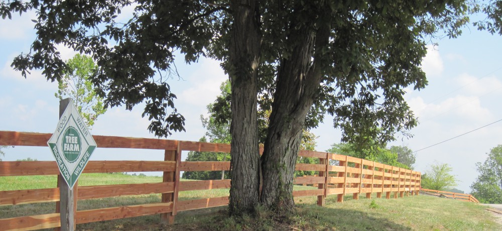
It is Nature’s way for the trees to come back. This forest is called mesophytic because its trees thrive in moderate annual rainfall. Though there is no single climax specie, the hardwood diversity is extensive and quality timber is possible when the trees are cared for. Care for them I try.
